


")

The "Landgraben" - The border of the Aachen empire
The Landgraben is a fortification of the Aachen Empire. It consisted of two ditches and a wall in between, planted with dense hedges. The first sections were already laid out in the 14th century. It was completed in 1611. Where the Wurm represents the border of the empire (or in the west the Senserbach in Aachen) the building could be dispensed with. The figure below shows the moat as a reddish border.
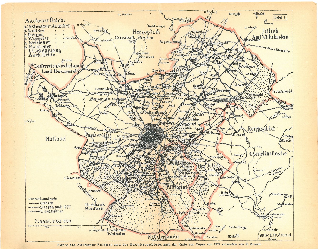 Copso map from 1777 in the revision by E. Arnold, 1923
Source: Wikimedia.org
Construction
The next figure gives an impression of the appearance of the moat. There are still remains in some places, especially in the Aachen Forest, mostly characterized by the bony hedges that have continued to grow there for centuries.
Carts could only pass at the so-called ‘Grindeln’. In Bardenberg, the border runs along the road "Landgraben", which is crossed by the "Grindelstraße". There was such a ‘Grindel’. There is also the monument 'Jeel Puet', a border crosser of that time angry about the high customs for his eggs. (https://www.webwuerselen.de/index.php/en/kultur-en/jeel-puet.html)
.JPG) Moat monument in Aachen - near Klausbergweg
Moat monument in Aachen - near Klausbergweg
Autor: Arthur McGill, GNU-Lizenz für freie Dokumentation
Quelle: Wikimedia.org
.JPG)
The border on the Trachot map
On the Tranchot map the border of the Aachen Empire is indicated. This is clear in many areas. In other areas it appears only very weakly in the map. In order to make the course of the Reich border/Landgraben available as a route for modern maps, it was traced on the Tranchot map. In some places, especially in Burtscheid, this is not possible without uncertainty. The next figure shows the course of the moat in front of the Tranchot maps
The route is provided as a GPX file. Almost all navigation apps or online maps such as Google Maps, Bing Maps or OpenStreetMaps can read this file format and display the track of the moat there. It should always be noted that the coordinates of the route come from the georeferencing in TIM Online. So, the route does not fit exactly on a modern map.
Use TIM Online and the project file Landgraben Tranchot.json to be able to analyze the route directly.
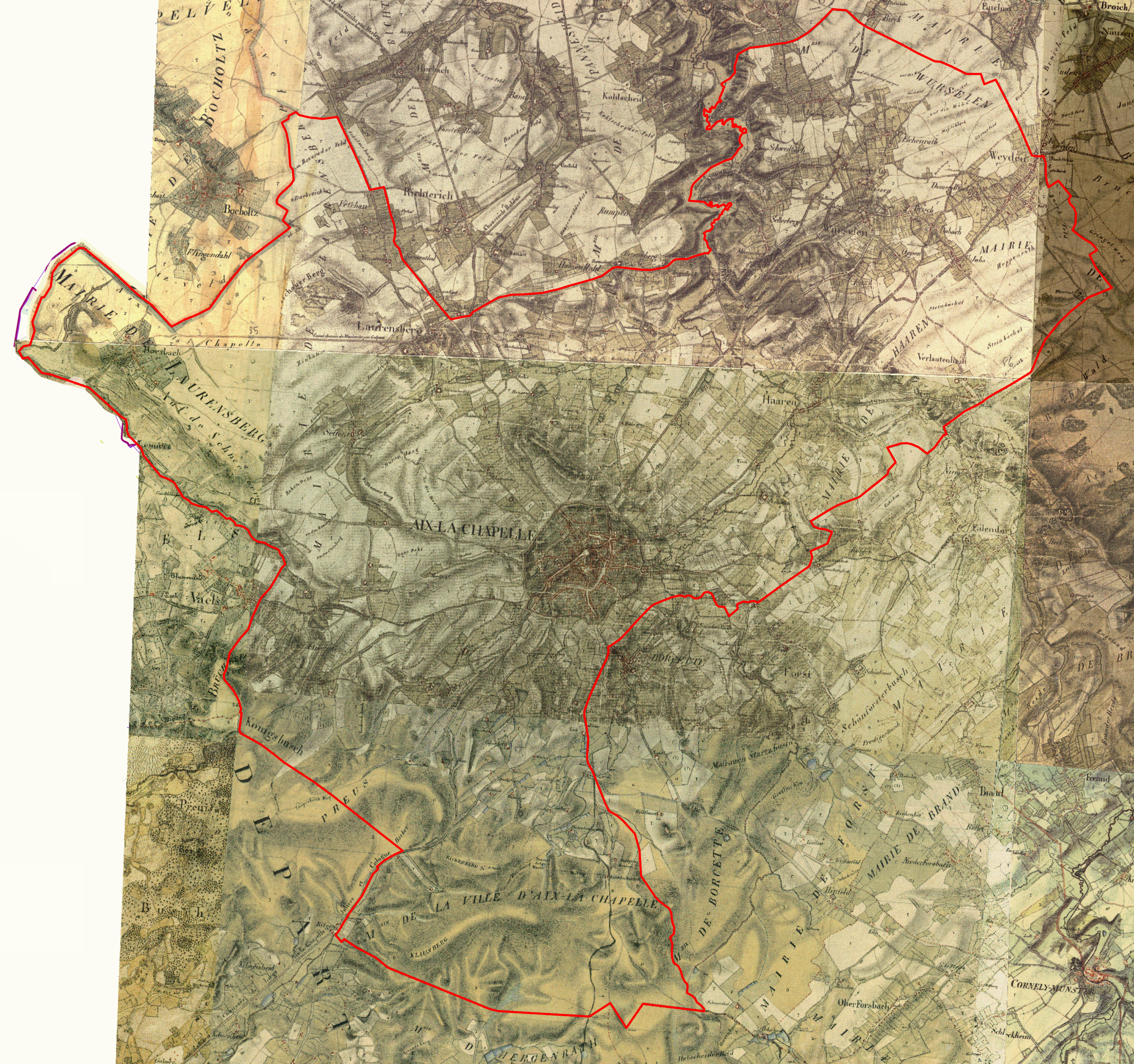 Landgraben on the Tranchot map
TIM-Online Projekt-Datei: "Landgraben Tranchot.json"
Route als GPX-Datei: "Landgraben Tranchot.gpx"
Click to enlarge![]()