


")

On the Tranchot map you can distinguish with compromises which roads existed in the villages and as a connection to the villages (blue lines in the relevant figures). From this one you can distinguish with some uncertainty paths, which probably had a lower importance and served more as access ways to the fields.
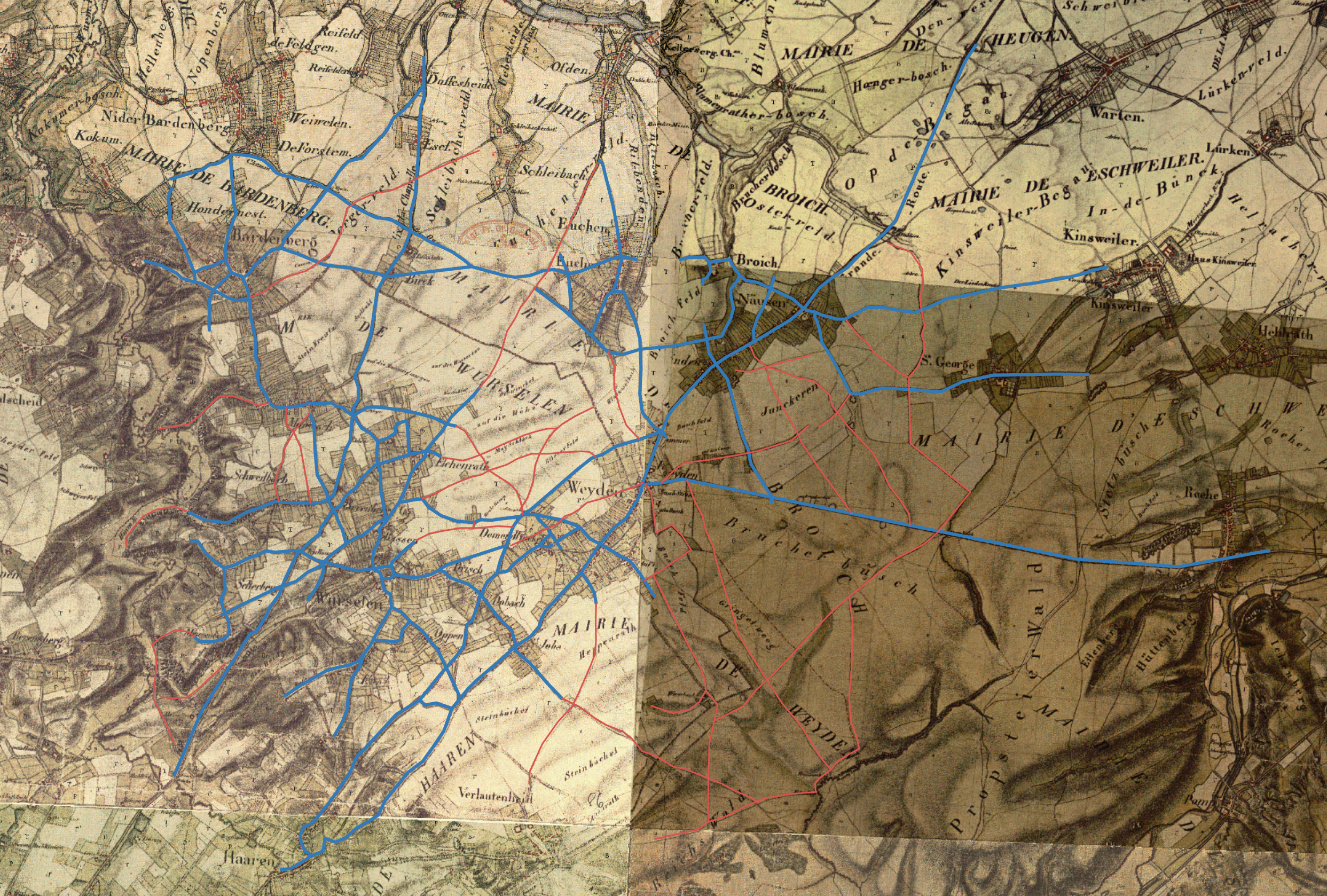
Road (blue) and path network (reddish) on the Tranchot map
TIM-Online Prjoekt-Datei: "Tranchot Haupt- und Nebenwege nach Tranchot.json"
Routen: "Tranchot Haupt- und Nebenwege nach Tranchot.gpx"
Click to enlarge
It is instructive to display this network on the WebAtlas map. When interpreting, of course, it should be noted that the paths are shifted, so they do not fit exactly into the WebAtlas map. The streets are still preserved to a large extent today.
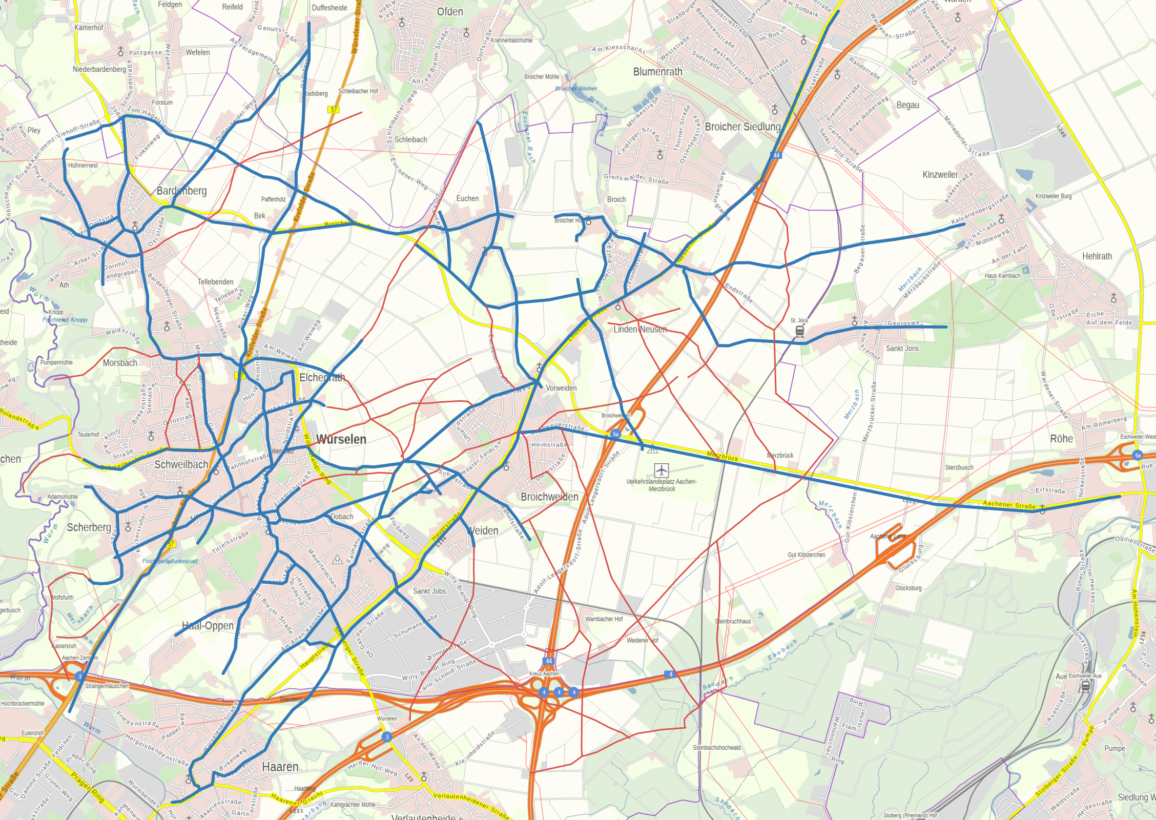
Road (blue) and path network (reddish) of the Tranchot map shown on the WebAtlas map
TIM-Online Projekt-Datei: "WebAtlas Haupt- und Nebenwege nach Tranchot.json"
Routen: "WebAtlas Haupt- und Nebenwege nach Tranchot.gpx"
Click to enlarge![]()