Page 13 - The picture was cropped; The original contains greeting text. - St. Sebastian in WikiPedia -
Map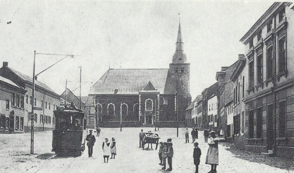
Würselen's parish church of St. Sebastian around 1900. Nothing has been preserved of the church mentioned in 870. The tower dates from the second half of the 12th century. From 1722 to 1725 a new church was built incorporating this tower according to the plans of the Aachen architect Laurenz Mefferdatis.
In 1906, district master builder Heinrich van Kann was in charge to plan another expansion. The electric tram started operating on the Haaren - Kaninsberg - Würselen - Bardenberg line in 1896 and continued until 1953.
Page 14 - At the location of the old cloister a home for the aged was errected (Seniorenheim). -
Map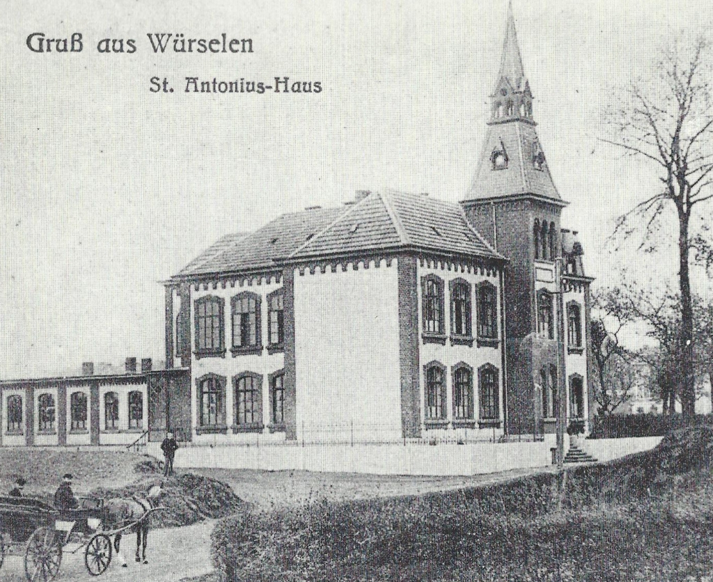
Page 14 - 'town hall' is today called the 'Alte Rathaus', the 'Old Town Hall, because there is new one at the 'Morlaix Platz'. - "Altes Rathaus" as cultural center -
Map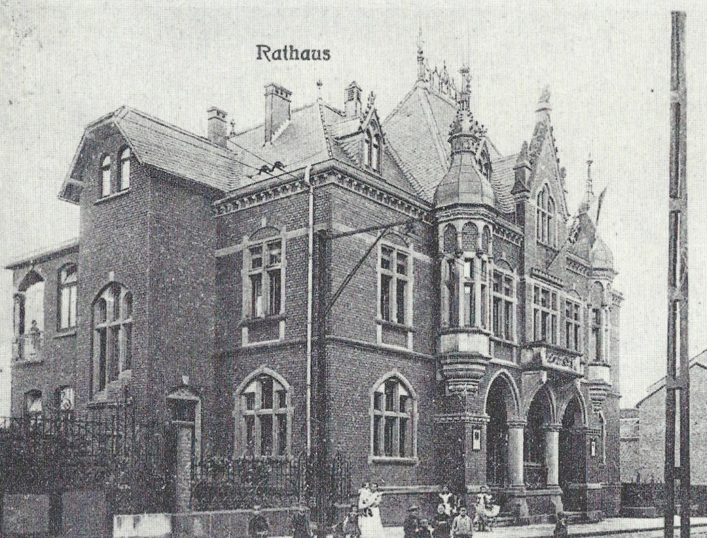
Two buildings that were built after the turn of the century: The St. Anthony's Monastery was built in 1900/1901 as a nursing home, in the annex was a kindergarten, then called 'Conservatory'. In addition, there was the opportunity for girls who were dismissed from the school to attend hand and housework courses. On April 10, 1901, the nuns were able to move into the monastery. The town hall was built between 1904 and 1905.
Page 15 - The restaurant 'Schwartz' is a dwelling house today. Linden is a district of Würselen. -
Map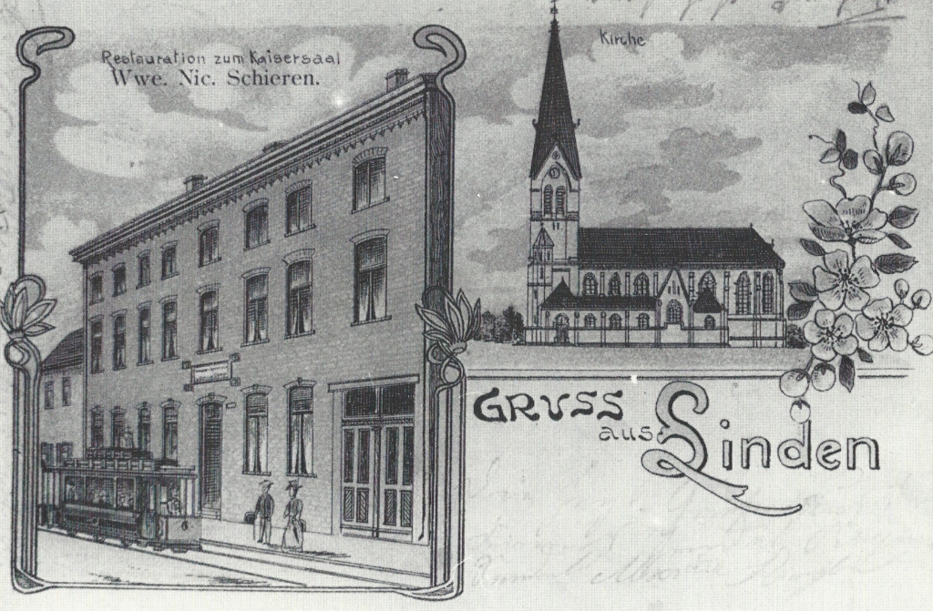
Postcard from Linden around 1908. St. Nicholas was built between 1903 and 1906, according to the plans of the Aachen cathedral architect J. Buchkremer. Until that time, the church in Broich had been the parish church for Linden and Neusen. The new church was consecrated on June 21, 1906.
The former restauration »Zum Kaisersaal« today is the restaurant Schwartz
Page 16 - top
Map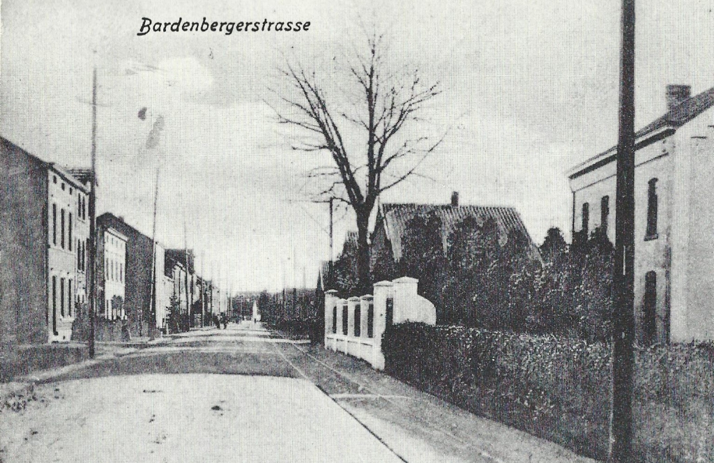
Page 16 - bottom - St. Balbina -
Map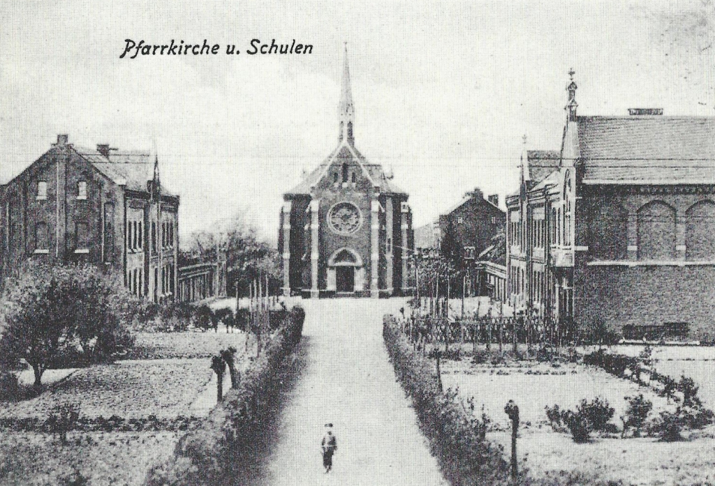
This postcard bears the postmark dated 9th 1907. At the top there is a view on Bardenberger Strasse at that time. Below is the parish church of St. Balbina and the boys 'and girls' schools. The school construction began in 1864. The church ‘Hurde’ was built from 1865 to 1867.
Initially, the chapel was an annex of the parish of St. Sebastian, whose pastor Moritz also held the first holy Mass on 15.11.1867.
Chaplain Paul Zaun of St. Sebastian became the rector. On the first of october, St. Balbina became a new parish.
Page 17 - Picture top right. The picture top left on this page is omitted.
Map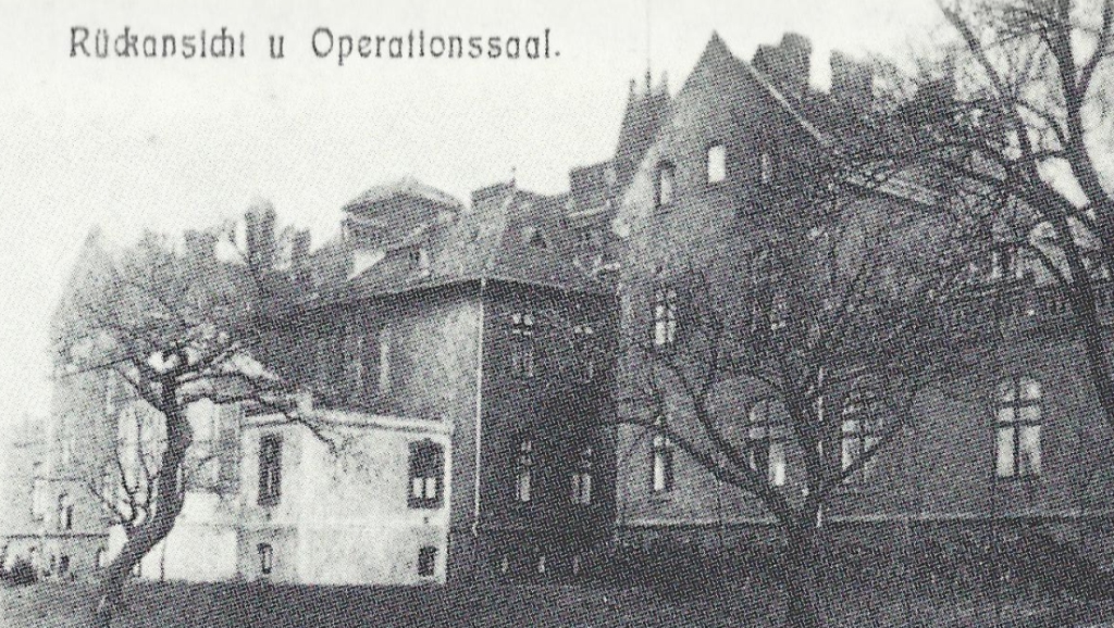
Page 17 - Picture bottom left -
Map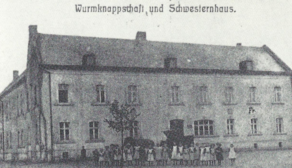
Page 17 - Picture bottom right -
Map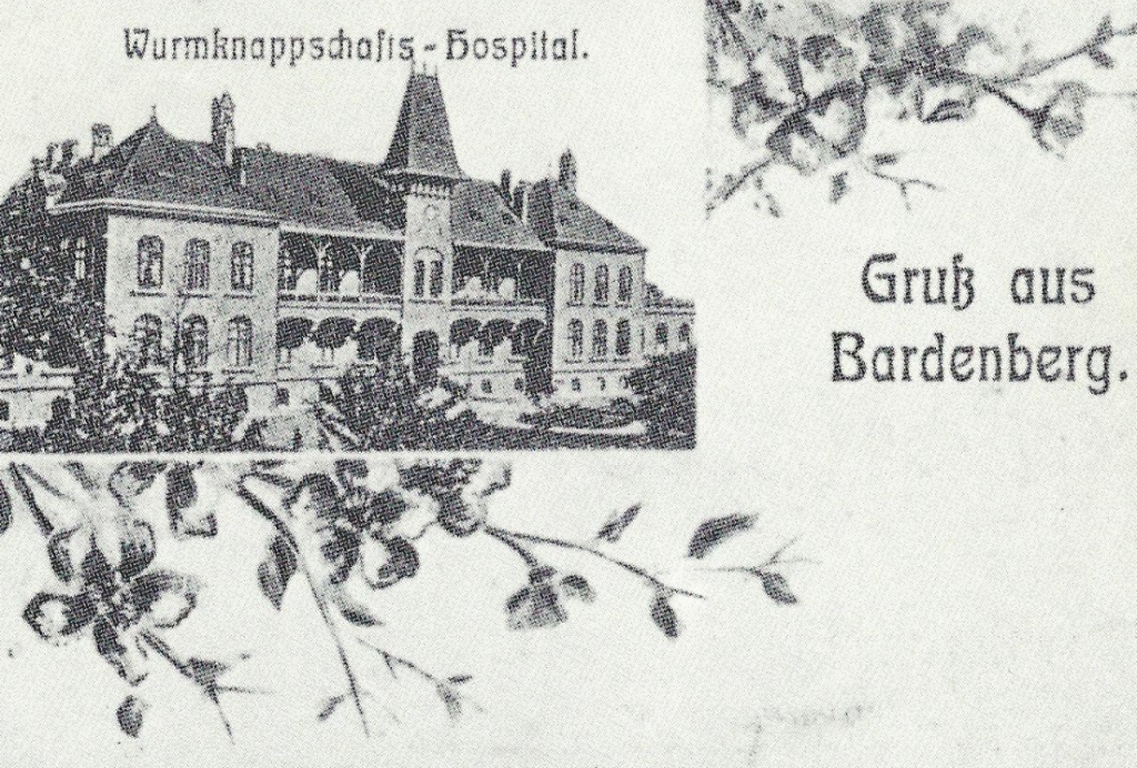
For over 125 years Bardenberg has a miners' hospital, the oldest in Germany. Initially housed in the former 'Gasthof Kolberg' in 1856 with 8 beds (now 'Haus Mintmans'). In 1868 they moved to the »Bauer'sche estate (bottom left). There were over 40 beds and an operating room. In 1901, the foundation stone was laid for a new building, which was inaugurated on the first of June 1904 (bottom right). Already in 1911, a further extension was necessary. At that time was also the chapel (top left) was built. Postcard after 1912.
Page 18
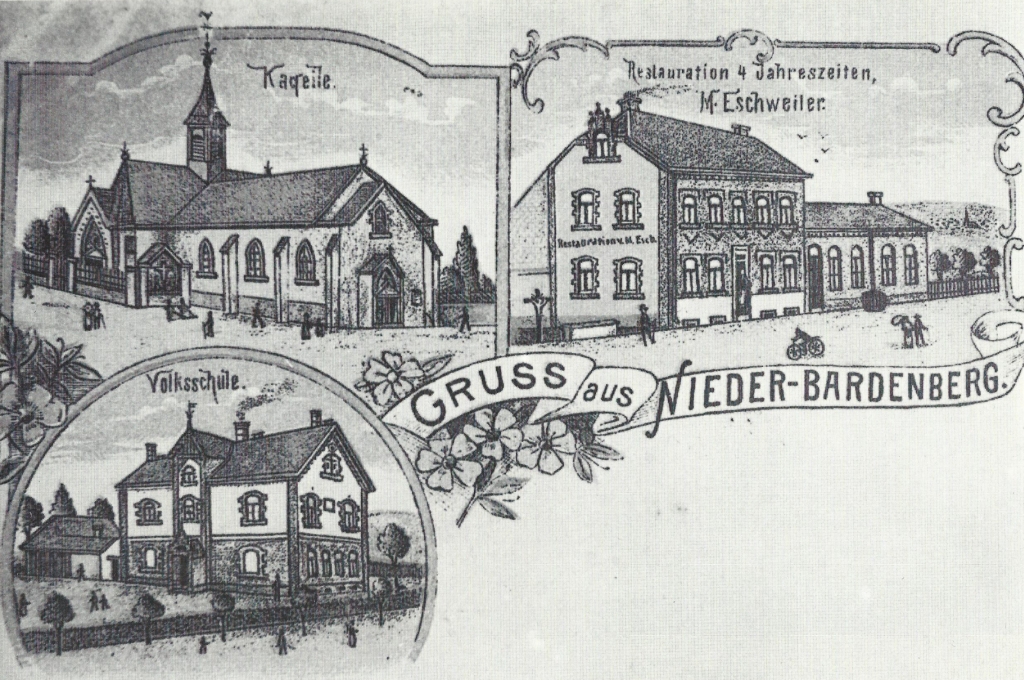
Until the municipal reorganization in 1972, Niederbardenberg belonged to the municipality of Bardenberg. The card - originated after 1900 – shows the chapel (expanded in 1888), the elementary school in 1900 and the restaurant ‘Four Seasons’ (“Vier Jahreszeiten”) from 1733.
Page 19 -
Map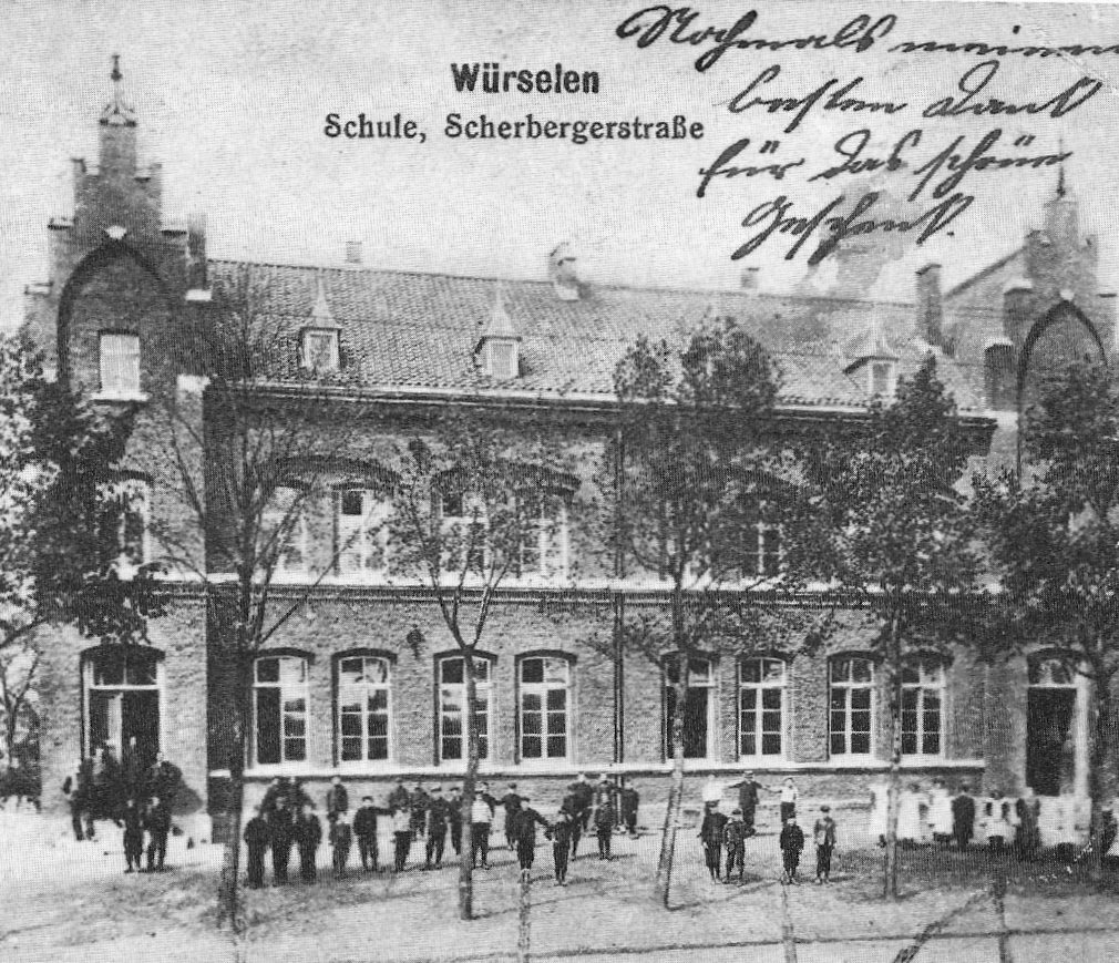
Postcard from 1915. The school in Scherberg was built in 1882/1883, and classes began on 1 May 1884. The building was located on the right side of Scherberger Straße (before confluence with the Brunnenstraße), was destroyed in the war and demolished.
Page 19 -
Map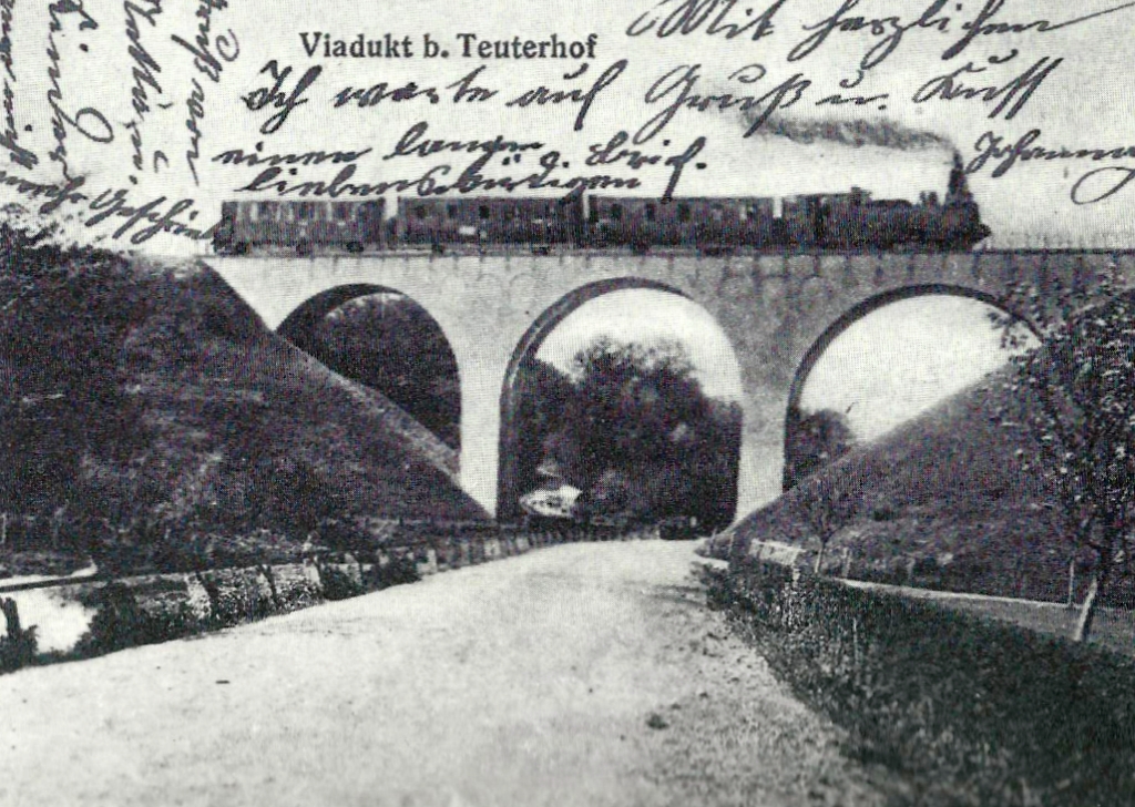
The viaduct at Teuterhof served the railway line Würselen - Kohlscheid. Built in 1891/1892, it was blown up in 1967 for a new road to Kohlscheid
Please observe the copyright of the city of Würselen.
For more information see here.
Some comments and explanations have been added.Such information is presented as follows:
Comments and explanations go here.

