


")

Features
The maps consist mainly of adjacent individual sheets with dimensions of 50 cm x 50 cm, which were originally produced on a scale of 1:20000. The location of the elements drawn on the map were elaborately triangulated, the only and then modern method for creating dimensionally accurate maps. At that time, there was still a long way to satellite navigation and the well-known online maps, which can now be easily called up on your smartphone.
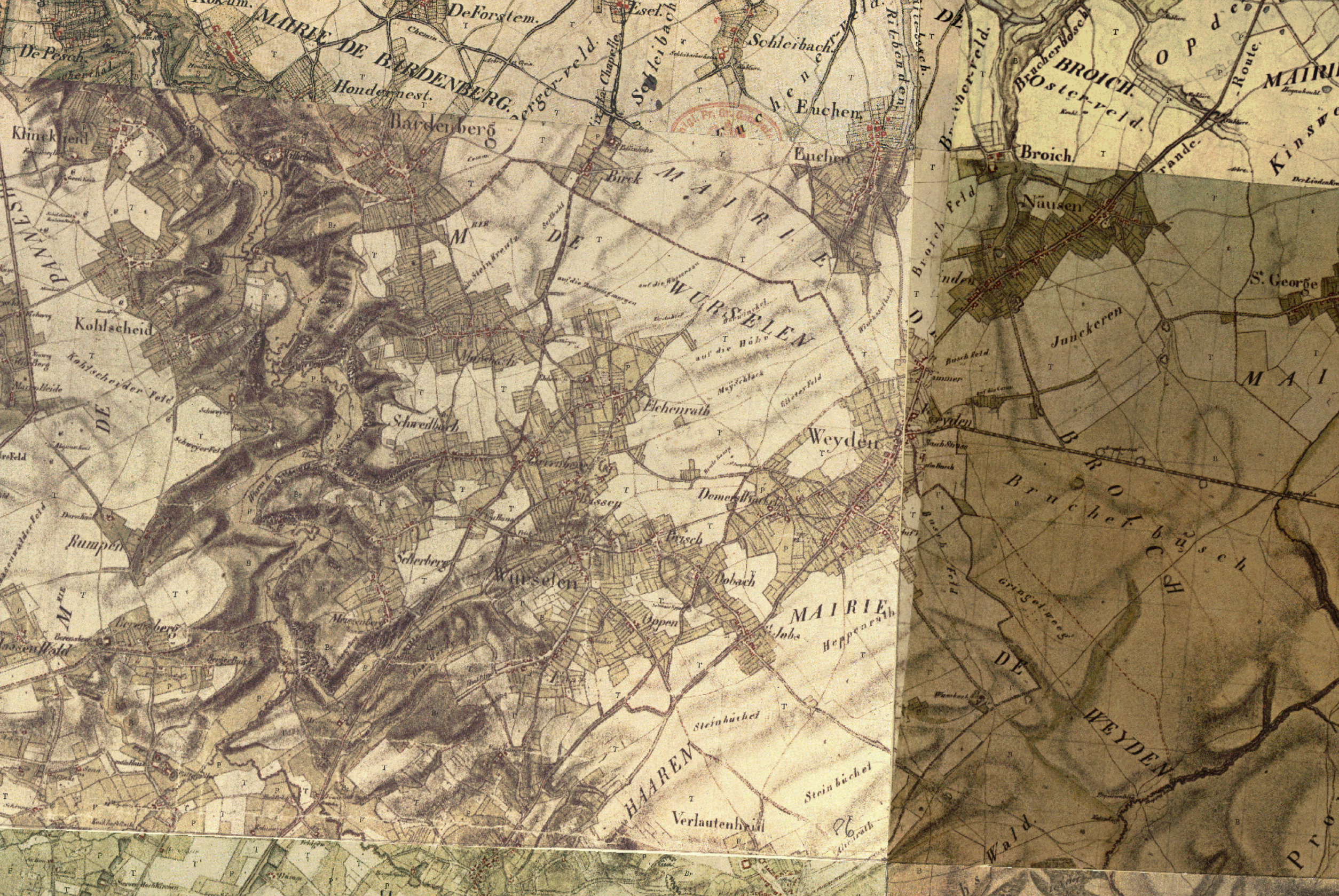 Excerpt from the Tranchot map covering the area of today's city of Würselen
Source: TIM-Online, Projekt-Datei: "Trachot Karte.json"
Click to enlarge![]()
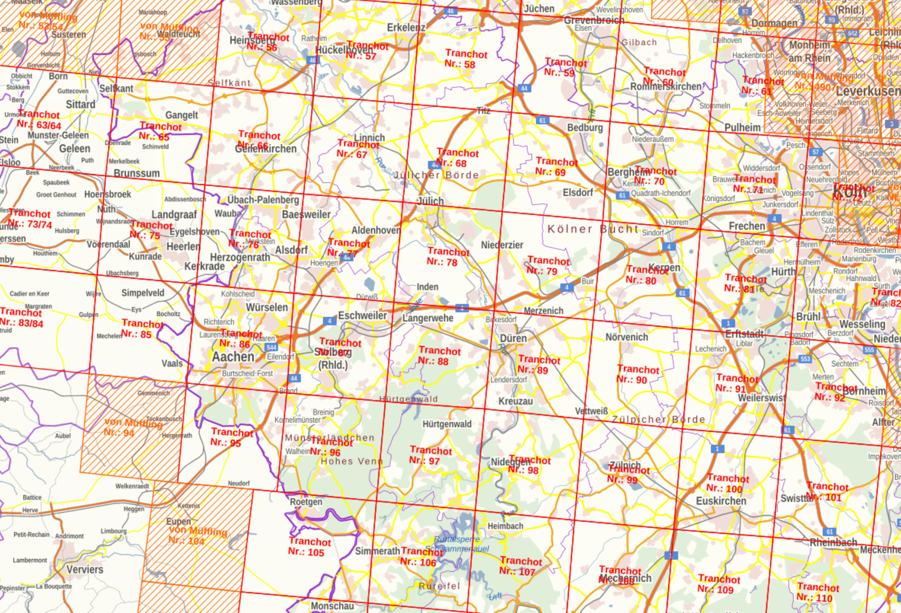
Leaf sections of the Tranchot map
Source: TIM-Online, Projekt-Datei: "Trachot Blattschnitte.json"
Click to enlarge![]()
Availability
The online geobase of North Rhine-Westphalia, which is offered via the TIM online portal (www.tim-online.nrw.de, see Chapter 7), contains the Tranchot/v. Müffling maps in the category 'Historical Maps' on a scale of 1:25000.
Description of the service at TIM-Online
Immediately after the occupation of the areas on the left bank of the Rhine by French revolutionary armies in 1794, a topographical survey of these areas was undertaken by French engineering officers under the direction of Colonel Jean Joseph Tranchot. As a basis for this work, Tranchot laid a triangular network over the area west of the Rhine in 1801/09. After the field recording sheets, the actual map sheets were drawn in multiple colors on a scale of 1:20,000. The War of Liberation (1813 to 1815) put an end to the topographical recording work by the French officers. Through the Congress of Vienna (1814 to 1815) and some subsequent treaties, the Rhineland and Westphalia were attributed to the Kingdom of Prussia. From 1817, Prussian officers under the direction of Major General Friedrich Karl Ferdinand Freiherr von Müffling continued the reception of the areas on the left bank of the Rhine and extended them further to the east. However, the map sheets recorded by the Prussian officers differ significantly from the French sheets, as they do not have their subtlety and richness of detail. Both map images of the Rhineland by Tranchot and von Müffling were reserved exclusively for military use and were intended to derive general staff maps. 127 sheets with a map image format of 50 cm x 50 cm, 21 sheets with a map image format of 47 cm x 45 cm and 23 map sheets in special formats are allocated to the territory of North Rhine-Westphalia. Since the georeferencing of the original map work is not yet available, the maps manually mounted in the sheet section of the TK 25 are presented here.
Georeferencing
The sheets of the Tranchot maps are mounted in the TIM-Online portal in such a way that they visually represent a coherent map. They can be blended with all other available maps in the geobase. You will find that this works with some uncertainties, not with the accuracy that modern maps offer.
A comparison of the Tranchot maps can be easily created in TIM-Online. For this purpose, the WebAtlas map, see here, is superimposed with the Tranchot map, which is set to 50% transparent.


Two sections with the overlay of the tracht map and WebAtlas
Source: TIM-Online, Projekt-Datei: "Tranchot ueber WebAtlas.json"![]()
In the section of the Dobach - Dommerswinkel area shown at the left, a 'rightward shift' of the main roads can be seen. In the Schweilbach area on the right, neither the right nor the upward shift is no longer so clear. Georeferencing cannot be improved simply by shifting the map to a certain direction to match modern map coordinate systems. The map is internally distorted.
Note
Cartography is about depicting the surface of the earth on a plane piece of paper. In principle, this cannot be achieved without errors. Depending on which method you use, the distances between the map points are not correct, or the direction is wrong, or the area is wrong. These methods, which are called projections, are used as needed. A map according to which you fly, or sail, should be true to direction, otherwise you will not reach your destination. You will be lost. A map according to which you buy land should be true to the area, otherwise the square meters are simply not right.
Maps that are printed follow certain fixed mapping rules. Common imaging methods are the so-called cylinder projections according to Mercator or Gauss, which take place along a fixed sequence of longitudes. Such images are unsuitable for online maps because they would lead to clipping effects that must not occur when scrolling a map on the screen. That's why online maps use a site-specific Mercator image. But here, too, for example, a distance from east to west is displayed larger at the bottom of the screen than at the top of the screen. This also applies to TIM-Online. So, there are distortions there as well.
When transferring geometries taken from the Tranchot map to online maps, adjustments are therefore required. This applies, in particular, to the course of the border of the Aachen Empire (Landgraben) presented below and the location of the villages from which Würselen emerged.