Page 30 -
Map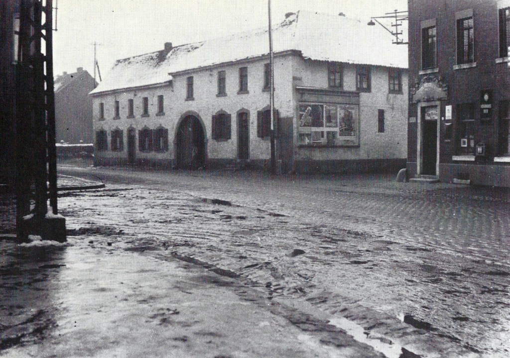
On Aachener Straße, intersection Neuhauser Straße (left) and Scherberger Straße (right) was the Kirchvink farm and the Kreiten/Reuters restaurant; Photo from January 1933.
Page 31 -
Map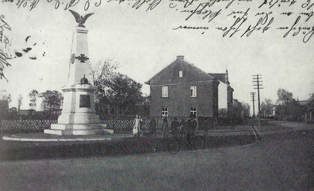
This postcard shows the monument on the Maarstraße/corner of Aachener Straße, postmark from the year 1915. This monument bore a plaque that shows the role of honor of the Würselen citizens of French-German war of 1870/71, which was donated by the Warrior's Association and inaugurated in 1911 with a large ceremony.
Page 31
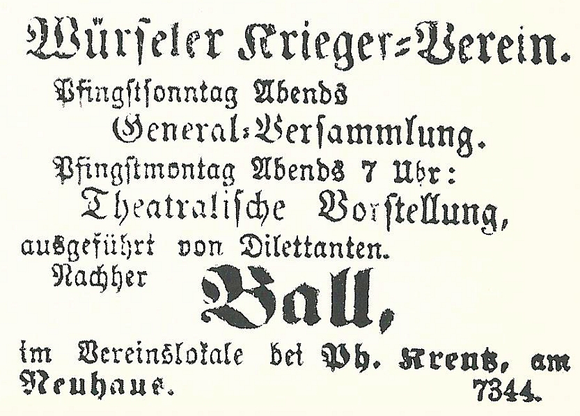
The display of 28 May 1871 (Repro: Wennmacher) is evidence of other activities.
Page 32 -
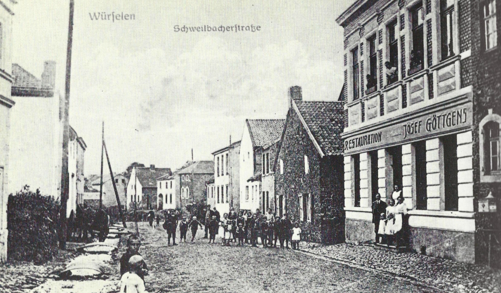
Schweilbach Strasse after the World War I in 1918. There are crew soldiers looking out of the window of the restaurant of Göttgens.
A big problem for the Schweilbach people was that through their road the pit water was directed to the worm. In 1867, therefore, a paved gutter was created for the first time, which led the water masses of the Teut mine (“Grube Teut”) and the Königsgrube, and a few years later also the wastewater of the Solvay plant to the river Wurm.
A further expansion took place in 1899. The Aachen County Administrative Report states:
"The extension of the path from Grevenberg through the village of Schweilbach to Teuterhof and the new construction of the new path from Teuterhof via Roland to Kämpchen is complete. This road forms a direct connection of the municipality of Würselen with the village of Kohlscheid. The busy traffic on the new way proves how necessary it was to expand it. The bridge, which runs over the river Wurm in the course of this road near Teuterhof, is constructed as a cement plate bridge with steel train bands lying in protruding jetties. It is the first of its kind in the local area. The costs of the wall construction were borne by the local authorities, the province, the association for coal construction in the Wurm area as well as the municipality of Würselen and of Pannesheide. "
Page 33 - Picture top
Page 33 - Picture bottom
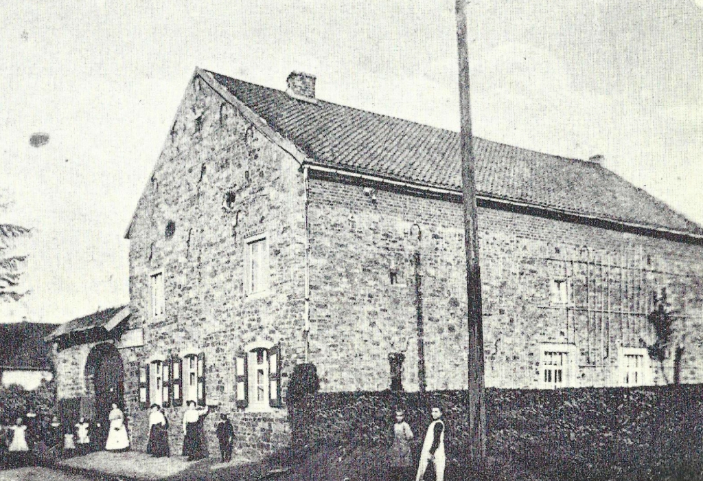
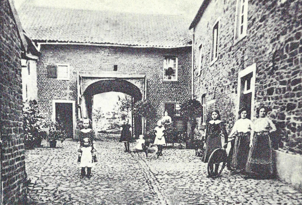
Views from Scherberg: ”Wohnhof on Scherberger Straße”, including the ‘Schankwirtschaft (restaurant) Simon Breuer’ (No. 89) circa 1910.
Page 34 -
Map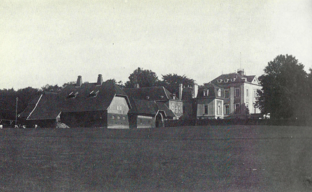
Kaisersruh manor around 1920; The manor used to belong to the Aachen patrician family Mauw and bore the name “Mauwenhof”. In 1818, in the year of the Aachen Monarch Congress, the canon of the Münsterstift, Freiherr Ludwig von Fisenne, was the owner of the estate. During this time, Tsar Alexander I visited the estate several times, which was therefore eventually renamed to “Kaisersruh”.
At the beginning of the 20th century, the manor house was rebuilt according to modern times. The park next to the Manor Kaisersruh still houses a valuable tree population with partly rare trees.
Zu Beginn des 20. Jahrhunderts wurde das Herrenhaus der Neuzeit entsprechend umgebaut. Der Park neben dem Haus Kaisersruh beherbergt noch heute einen wertvollen Baumbestand mit teilweise seltenen Bäumen.
Page 35 - Today there is a different store. -
Map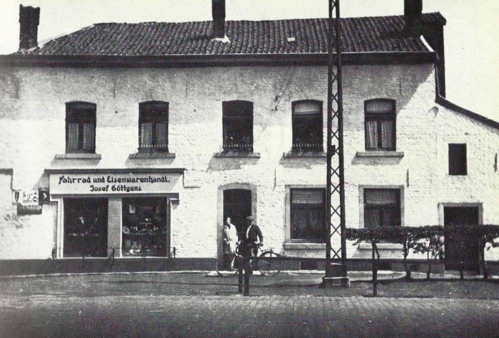
Aachen Straße junction Kaiserstraße, bicycle and hardware store Josef Göttgens in the 1920s. Today Household Goods Göttgens.
Page 36 -
Map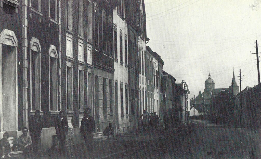
Upper Neuhauser Strasse and St. Sebastian in the background, in 1921.
Page 37 -
Map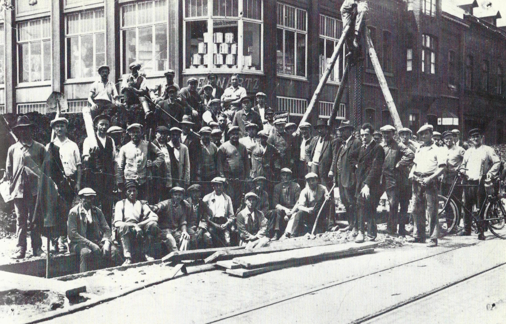
Kaiserstraße (corner of Bahnhofstraße) during the canal construction at the end of the 1920s.
Page 38 -
Map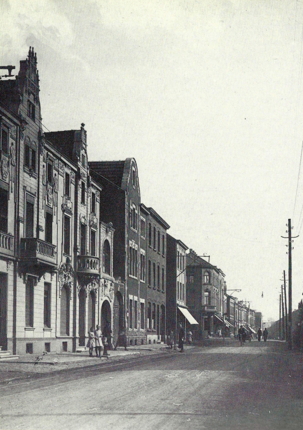
Kaiserstraße (straight house numbers) left and right of the intersection of today's Bahnhofstrasse (corner house see next page) around 1920.
Page 39 -
Map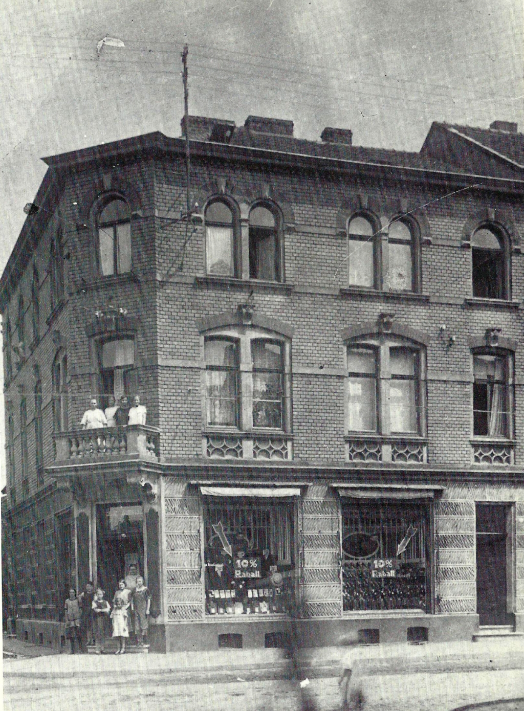
Zumbusch Commercial House, corner of Kaiser-and today's Bahnhofstraße.
.

