Page 50 -
Map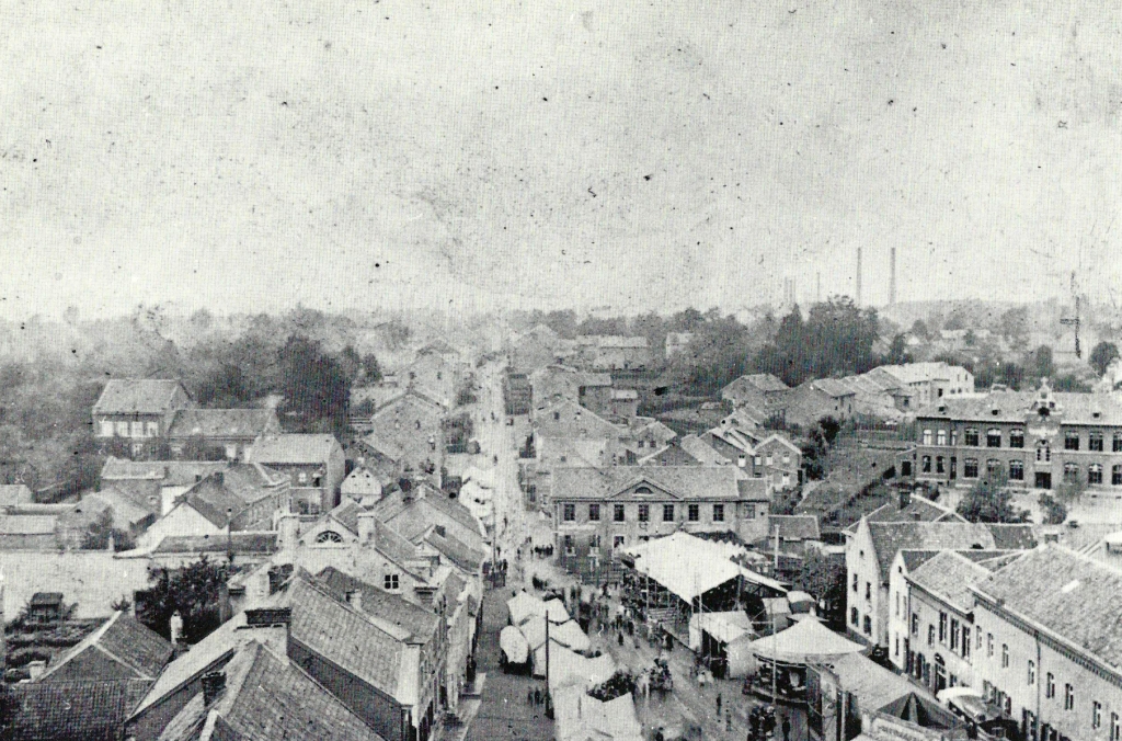
View from the church tower of St. Sebastian to the market square with ‘Kirmes’, about 1900. In the picture you can see three Würselen schools, the school Neuhauser Strasse (left edge of the picture in the middle), the school market (at the level crossing) and the school Friedrichstraße (right edge of the picture in the middle).
In the background, the chimneys of the soda plant Honigmann.
Page 51 -
Map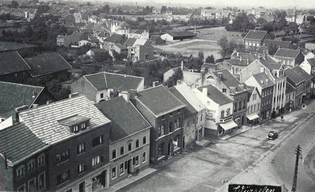
About 30 years later, in the 30s, a photographer got back on the church tower. At the house with the advertising on the gable side (“ Pelze”), the “Tittelsjaas” ends up on the market, at that time really an alley. Also on display are Neuhauser Strasse, the school there, the monastery street, the school Lehnstraße and the Antonius Monastery (far right above).
Page 52 - Picture at the top -
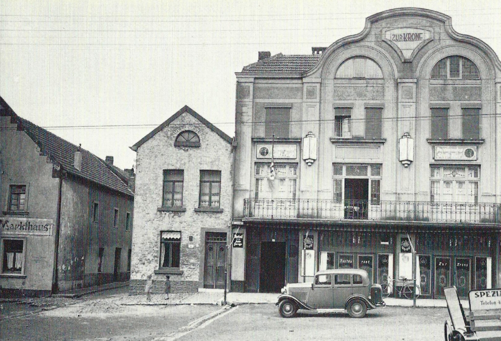
Page 52 - Picture at the bottom - The restaurant "Zum Kank" does not exist anymore. -
Map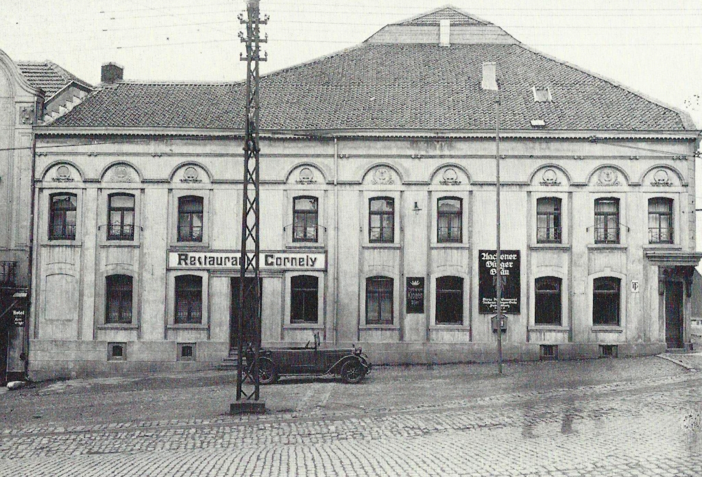
Before and after the First World War, a lively club life took place in the restaurants around the market square. Two of these houses were Strang (“Zur Krone”, picture above) and Cornely (“Zum Kank”, picture on the right), which were next to each other (views in their late 20s, early 30s).
Page 53 -
Map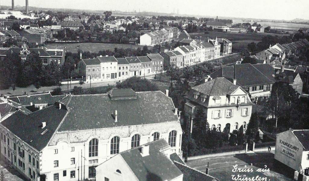
Taken from the church tower around 1930: Restaurant “Zum Kank”, right next to it the rectory, behind it the youth center, Friedrichstraße, Mittelstrasse, the post office building on Lindenplatz, the grandstand of the Rhenania sports field, the buildings of the Consumers ' Association Eintracht (right above) and the limestone of Solvay plant (top left).
Page 54 -
Map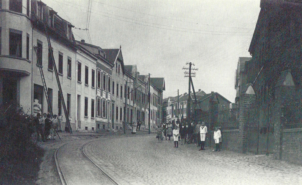
Oppener Straße between Ring-and Ankerstraße 1921.
Page 55
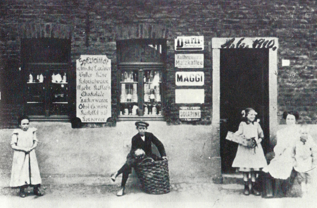
Small shop on Sebastianusstraße "En der Mur 'k" 1910.
Page 56
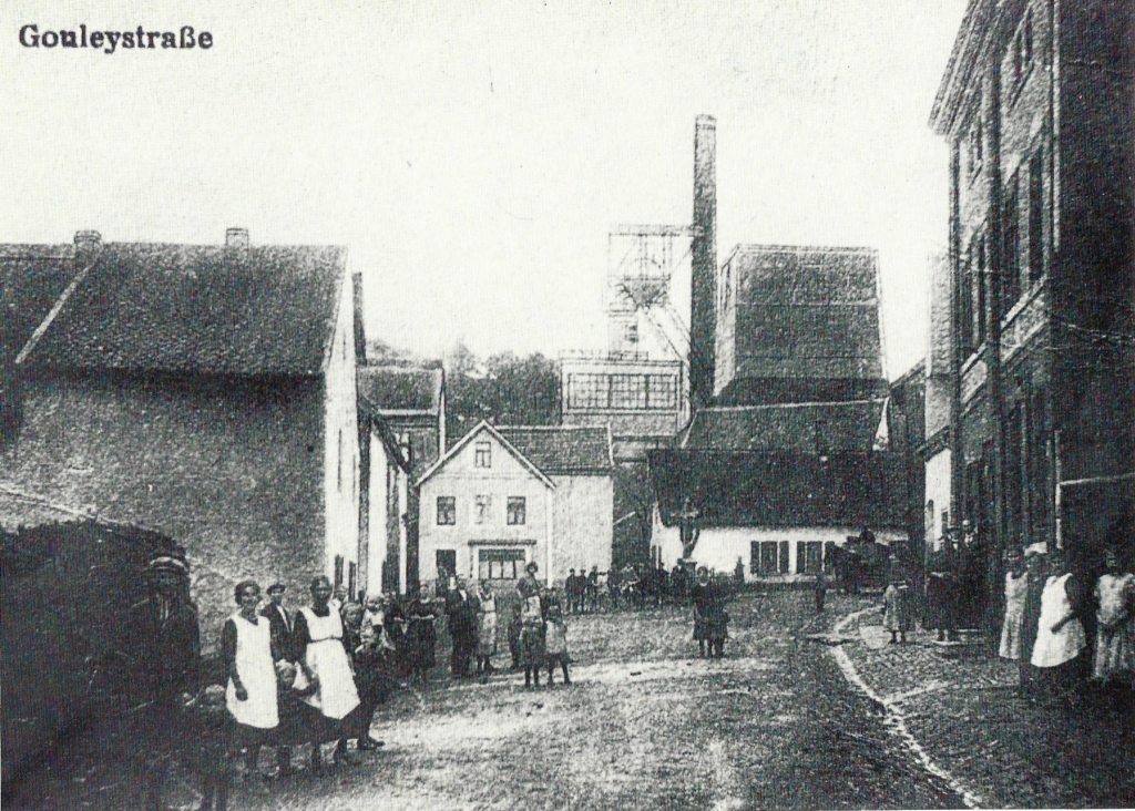
Gouleystraße at the turn of the century.
Page 57
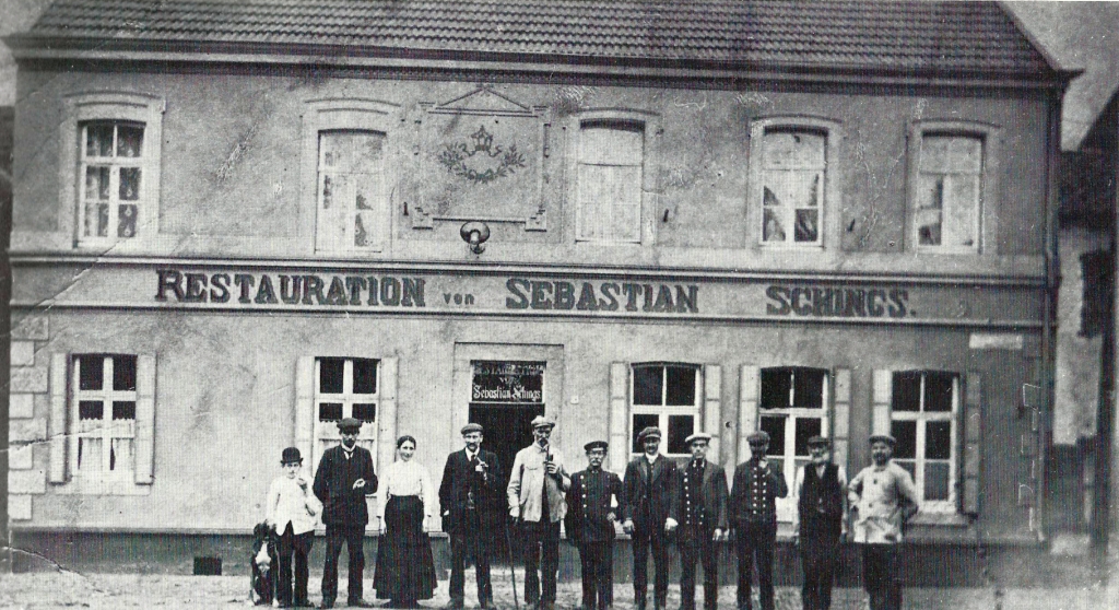
At the beginning of Bardenberger Strasse in Morsbach was the Schings restaurant; The photograph was taken in 1914.
Page 58 -
Map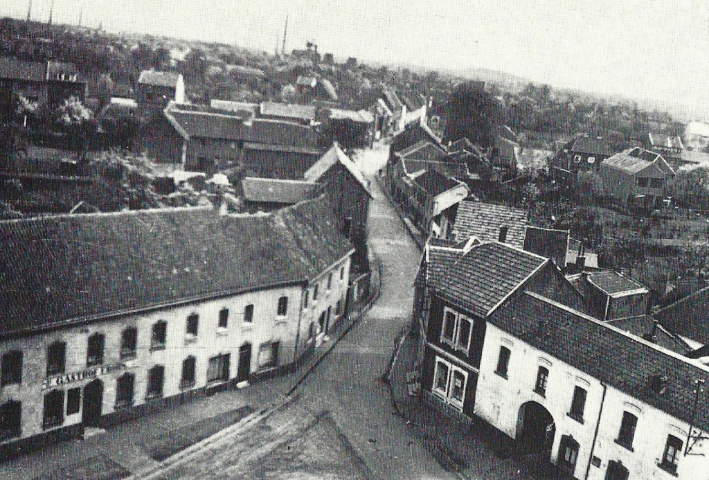
Corner Kirchenstraße and Grindelstraße, seen around 1934 from the tower of the church of St. Peter and Paul.
Page 58 -
Map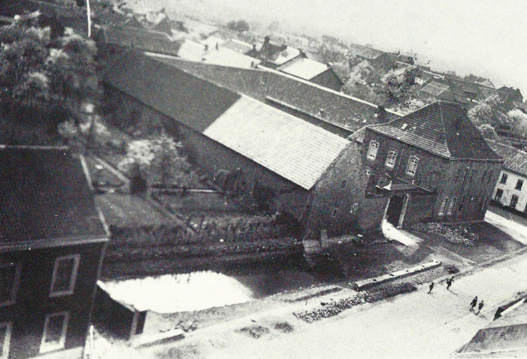
Also photographed from the church tower: Stone house Bardenberg's oldest surviving house with a mansion, archway, farm buildings and a remnant of a former moat (circa 1934).
Page 59 -
Map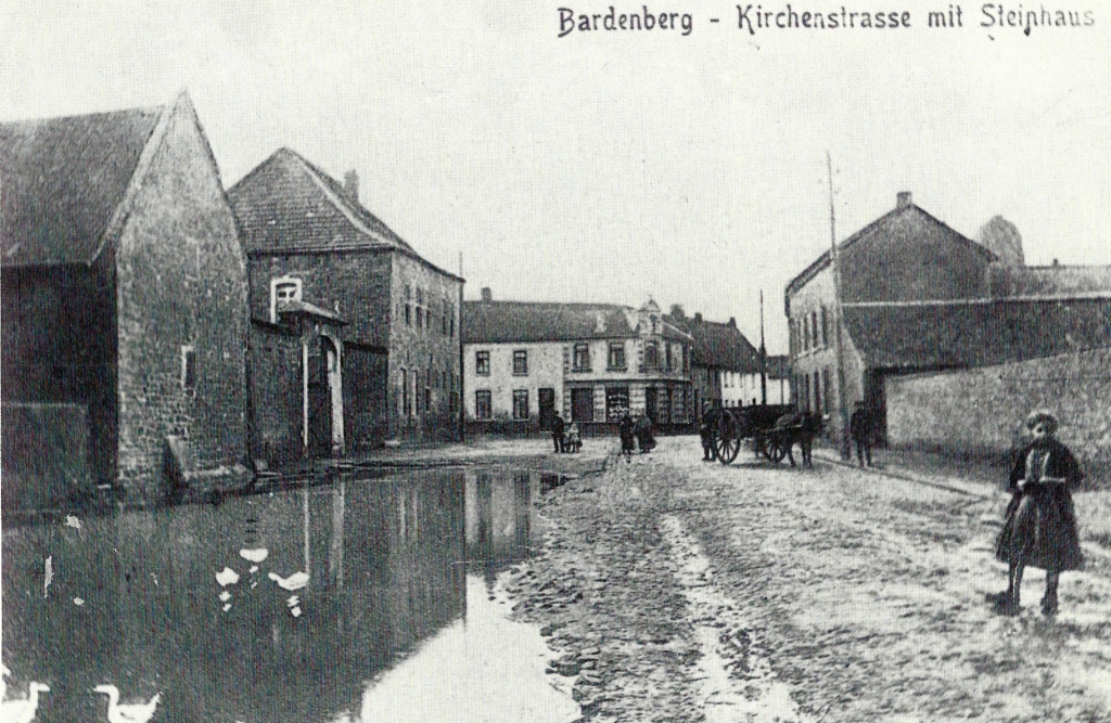
The Fronhof Steinhaus is likely to be the courtyard, which came into the possession of King Lothar II in 867 along with lands. This is recorded in the document, which Bardenberg (“Bardunbach”) also mentions for the first time.
.

