History
Würselen recieves its town charter
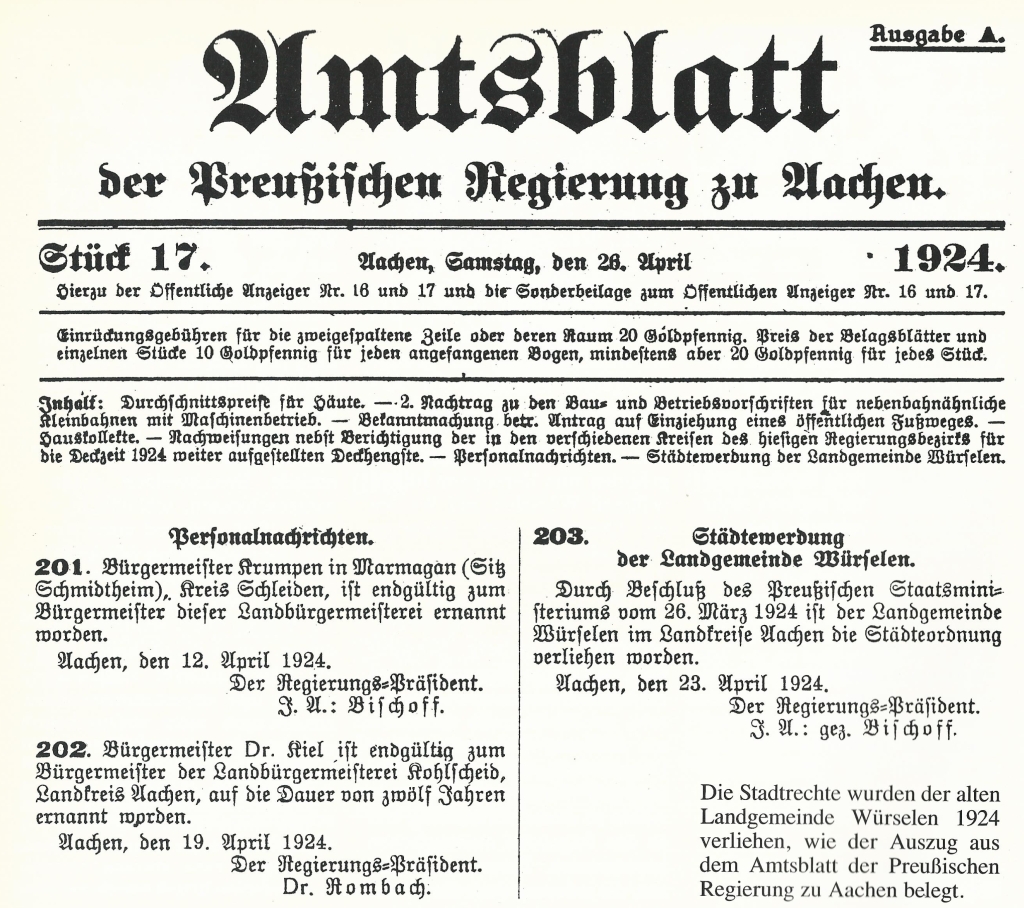
As the Official Gazette of 26 April 1924 shows, the 'Landgemeinde Würselen' was granted the town charter order by decision of the Prussian State Ministry on 26 March 1924. Since then, of course, the town of Würselen has belonged to the district of Aachen.

Würselen

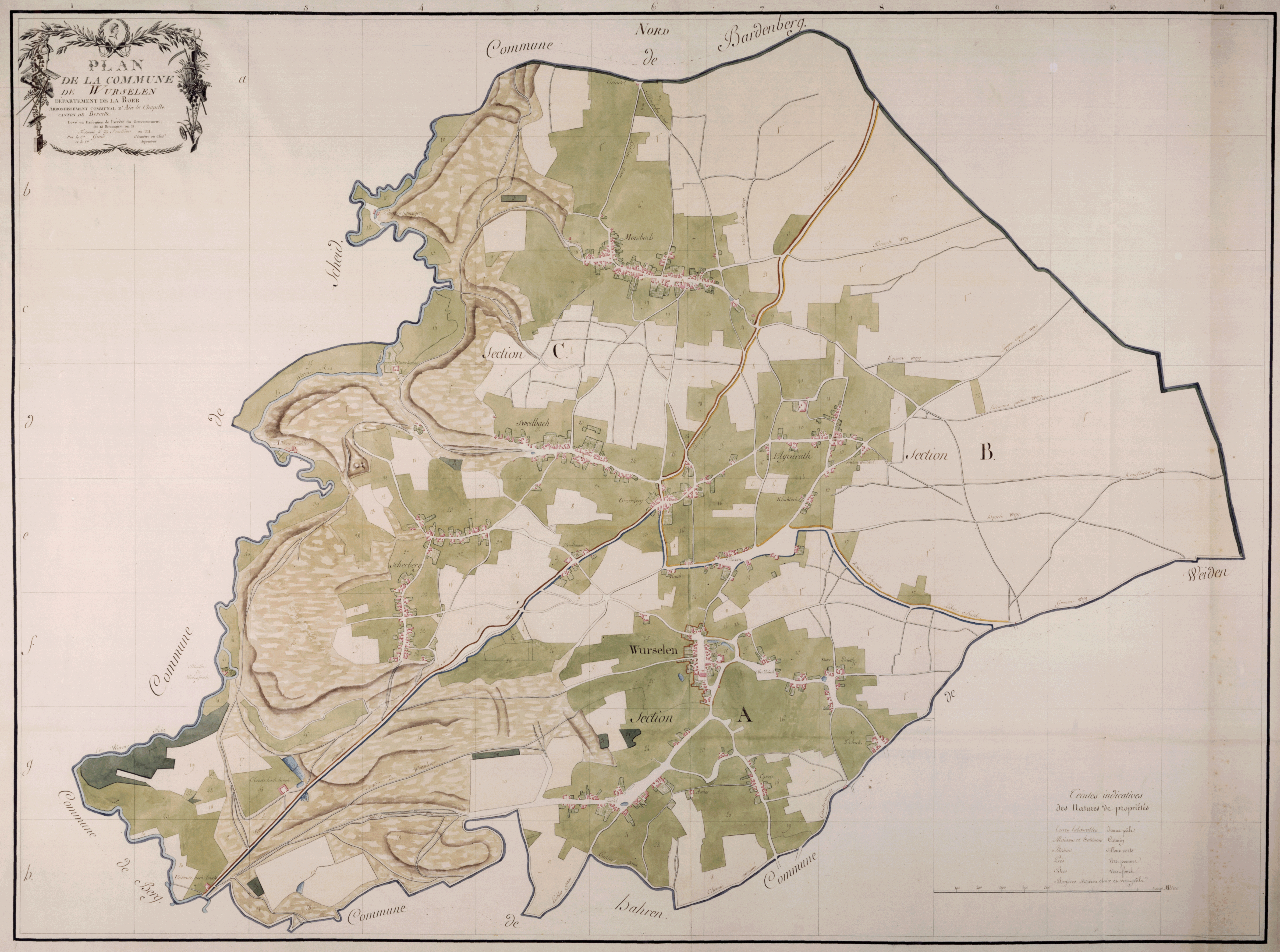
Source: Not clear! If you can contribute any information about this plan please let us know. Due to the original date of the plan we are not expecting particular right that will stop the publication here.
Plan de Commune Würselen 1803
Click to enlarge the map
The Familienbuch Euregio is using parts of this map.
Plan Weiden 180?
We are sorry, but we do not have the plan yet.
If you have infomartion on how to get the plan please let us know. Thank you!
Plan Bardenberg 1807

Quelle: Land NRW (2020) Datenlizenz Deutschland -Namensnennung - Version 2.0 (http://www.govdata.de/dl-de/by-2-0)
Plan de Geometric Bardenberg 1807 (Landesarchiv, own compilation of two sheets)
Zur Vergrößerung auf die Karte klicken
Link to the source Landesarchiv.
Plan Broich 1806

Quelle: Land NRW (2020) Datenlizenz Deutschland -Namensnennung - Version 2.0 (http://www.govdata.de/dl-de/by-2-0)
Plan de la commune de Broich. Dép. de la Roer. Arr. comm. d'Aix-la-Chapelle. Canton d'Eschweiler [mit Angabe der Bodenbeschaffenheit]. Levé en exécution de l'arrêté du gouvernement du 12 brumaire an 11. Terminé le 20 novembre an 1806. Par Maubach, géomètre en chef, et Pierre Kuckelkorn, arpenteur
Click to enlarge the map. (ca. 100 MB)
Link to the source Landesarchiv.

